

Devastation Trail, located within Hawaii Volcanoes National Park, offers a unique glimpse into the raw power of volcanic activity. This trail, formed by the explosive 1959 eruption of Kilauea Iki, showcases a landscape dramatically altered by lava and ash, creating a stark and otherworldly environment. This travel guide aims to equip visitors with essential information to fully appreciate and safely explore Devastation Trail, ensuring a memorable and enriching adventure.
Highlights
- The trail offers a rare glimpse into the raw power of volcanic activity, showcasing a dramatic and otherworldly environment.
- Devastation Trail is an easy, paved trail suitable for all ages and fitness levels.
- Learn about the history and science of volcanic eruptions with informative signage along the trail.
- Enjoy breathtaking views of the Kilauea Iki Crater and the surrounding volcanic landscape.
- Keep an eye out for native birds and plants that have adapted to the volcanic environment.
History
The Rainforest Before (Pre-1959)
Lush and Vibrant
Before the dramatic transformation, the area that now encompasses the Devastation Trail was a thriving rainforest, abundant with lush vegetation and diverse wildlife. It was a serene and vibrant part of the park, offering a stark contrast to its current appearance.
Signs of Unrest (Early 1959)
In the months leading up to the eruption, frequent earthquakes rattled the region, signaling the volcanic activity brewing beneath the surface. These tremors were the Earth’s way of hinting at the significant changes that were about to unfold.
The Eruption Unleashed (1959)
Kilauea Iki Erupts
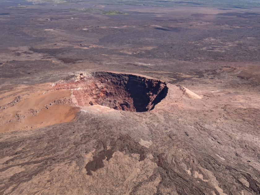
In November 1959, the Kilauea Iki crater erupted in a spectacular display of nature’s power. Over five weeks, massive lava fountains reached up to 1,900 feet, spewing cinders and lava that dramatically reshaped the landscape.
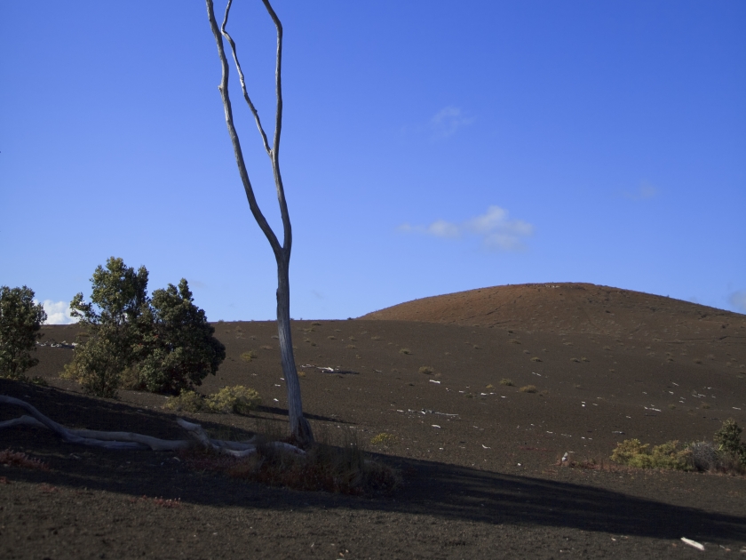
Cinder Burial
The once-lush rainforest was buried under a thick layer of volcanic cinders, creating a stark, otherworldly environment. This sudden transformation from vibrant forest to barren terrain is what gives the Devastation Trail its name and unique appeal.
After the Eruption (Post-1959)
Birth of the Trail
In the aftermath of the eruption, the National Park Service established the Devastation Trail to allow visitors to witness the stark beauty of the transformed landscape. The trail offers an easy, accessible path through the heart of this remarkable terrain, providing a firsthand look at the effects of volcanic activity.
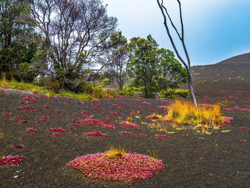
Nature's Resilience
Despite the initial devastation, the trail showcases the resilience of nature. New plant life has begun to take root in the volcanic cinders, illustrating the ongoing process of ecological succession. This juxtaposition of destruction and renewal adds a poignant layer to the trail’s experience.
A Scientific Treasure
The Devastation Trail remains a valuable resource for scientists studying volcanic activity and ecological recovery. The area provides insights into the processes of post-eruption landscape transformation and the resilience of life in the face of natural disasters.
At Present
Visiting the Devastation Trail offers a unique opportunity to explore a landscape that tells a powerful story of destruction and renewal. Whether you’re captivated by the raw beauty of the volcanic terrain, interested in the science behind the eruption, or inspired by nature’s resilience, this trail is a must-visit destination in Hawaii Volcanoes National Park.
Trail Description
Length and Difficulty Level
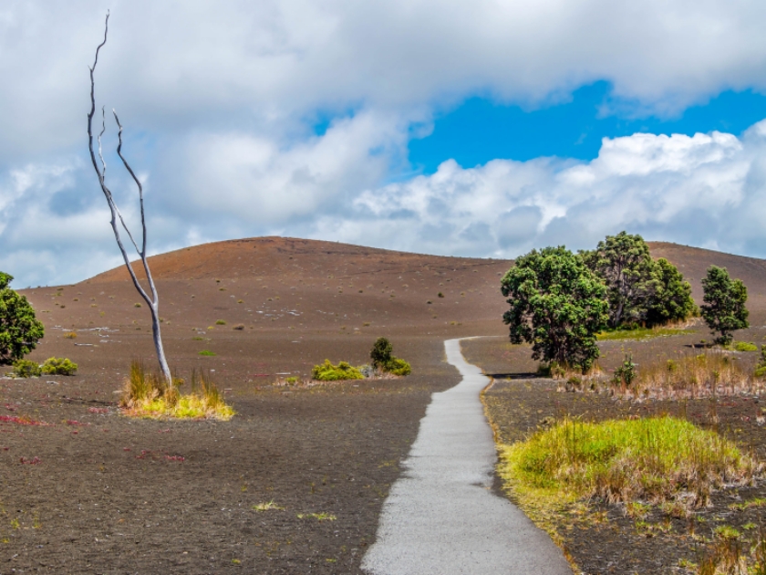
Devastation Trail is a relatively short and easy hike, spanning approximately 1 mile (1.6 kilometers) round trip. The trail is well-marked and features a gentle incline, making it suitable for hikers of all ages and skill levels, including families with children.
Terrain and Notable Features
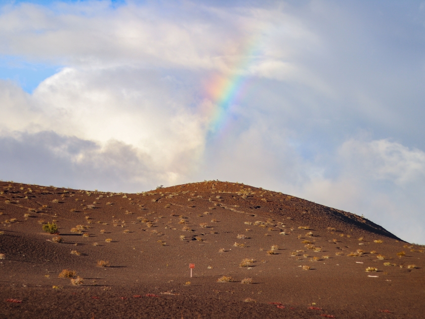
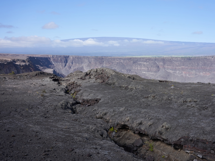
The trail traverses a landscape that has been dramatically altered by volcanic activity, characterized by barren fields of cinder and ash. Hikers will encounter unique geological formations, including lava trees and impressive views of the Kilauea Iki Crater, offering a stark contrast to the lush greenery found elsewhere in the park.
Accessibility for Different Types of Hikers
Devastation Trail is highly accessible, with a paved path that accommodates wheelchairs and strollers, ensuring that everyone can enjoy the stunning volcanic scenery. Its easy terrain and short length make it an ideal choice for casual walkers, families, and those seeking a brief but impactful hiking experience.
What to Expect on the Trail
Unique Geological Formations
As you walk along the Devastation Trail, you’ll encounter fascinating geological formations shaped by the 1959 eruption of Kilauea Iki. The trail features fields of volcanic cinder and ash, lava trees that were formed when lava flowed around standing trees and other unique volcanic rock formations that highlight the powerful forces of nature.
Flora and Fauna Along the Trail

Despite the barren appearance, the trail is home to a variety of resilient plant species slowly reclaiming the landscape. Look for hardy pioneer species like ʻōhiʻa lehua, which add splashes of color to the otherwise stark environment. Birdwatchers may also spot native Hawaiian birds, such as the ʻapapane and ʻamakihi, flitting among the sparse vegetation.
Scenic Viewpoints and Photo Opportunities
The trail offers several scenic viewpoints that are perfect for photography enthusiasts. Capture stunning images of the Kilauea Iki Crater, the dramatic contrast between the black volcanic landscape and the green surroundings, and the unique geological features along the way. These viewpoints provide ample opportunities to appreciate and document the raw beauty of this volcanic terrain.
Tips for Visiting
- Check Weather Conditions: Weather can change rapidly; bring a light jacket or rain gear.
- Wear Comfortable Footwear: The trail is short but can be uneven; sturdy shoes are recommended.
- Stay Hydrated: Carry water, especially on hot days.
- Bring Sun Protection: Use sunscreen, hats, and sunglasses to protect against the sun.
- Follow Trail Markings: Stay on designated paths to protect the landscape and ensure safety.
- Pack Light: A small backpack with essentials is ideal.
- Respect Wildlife: Observe animals from a distance and do not feed them.
- Leave No Trace: Carry out all trash and respect the natural environment.
- Utilize Visitor Resources: Take advantage of maps, guides, and ranger programs available at the park.
- Time Your Visit: Early mornings or late afternoons are less crowded and offer cooler temperatures.
Best Times to Visit
The best times to visit Devastation Trail are during the early morning or late afternoon when the temperatures are cooler, and the trail is less crowded, allowing for a more peaceful and enjoyable experience. Visiting during these times also offers the best lighting for photography, enhancing the dramatic contrasts of the volcanic landscape. While the trail is accessible year-round, the dry season from April to October provides the most favorable weather conditions, ensuring a comfortable and memorable hike.
Nearby Attractions
While exploring the Devastation Trail, be sure to check out other nearby attractions within Hawaii Volcanoes National Park. Highlights include the Crater Rim Trail, offering panoramic views of the Kilauea Caldera, and the Thurston Lava Tube, where you can walk through a massive, ancient lava tunnel. Don’t miss the informative exhibits at the Kīlauea Visitor Center and the Jaggar Museum, which provide valuable insights into the park’s volcanic activity and geology. For a more extensive adventure, consider day trips to the Halemaʻumaʻu Crater overlook or a guided tour to witness ongoing volcanic activity, making your visit to the park even more enriching.
Accommodation Options
For a comfortable stay near Devastation Trail, consider lodging within Hawaii Volcanoes National Park at the historic Volcano House, offering cozy accommodations with stunning views of the Kilauea Caldera. Just outside the park, Volcano Village Estates provides charming bed and breakfast options in a tranquil rainforest setting.
Frequently Asked Questions (FAQs)
Devastation Trail is a short, easy hiking trail in Hawaii Volcanoes National Park that showcases the dramatic aftermath of the 1959 Kilauea Iki eruption.
Devastation Trail is approximately 0.5 miles (0.8 kilometers) long, making it a quick and accessible hike for all visitors.
Yes, Devastation Trail is wheelchair accessible, featuring a paved path suitable for strollers and wheelchairs.
On the Devastation Trail, you can see cinder fields, lava formations, and the stark landscape left by volcanic activity, offering a unique glimpse into the power of Kilauea.
Yes, entry to Devastation Trail requires a park entrance fee for Hawaii Volcanoes National Park, which is $30 per vehicle as of 2024.
No, pets are not allowed on Devastation Trail to protect the park’s wildlife and ensure the safety of all visitors
How to Get There
By Car
To reach the Devastation Trail by car, start by heading towards Hawai’i Volcanoes National Park on Hawaii’s Big Island. Once you enter the park, take Crater Rim Drive and follow the signs towards the Devastation Trail parking area. It’s a relatively short drive from the park entrance, and the trailhead is well-marked, making it easy to find.
By Bus
If you prefer public transportation, you can take a bus to Devastation Trail. The Hele-On Bus service provides routes that connect various parts of the Big Island to Hawai’i Volcanoes National Park. Check the current schedules to find the most convenient time and route. Once you arrive at the park, use the internal shuttle service to get closer to the Devastation Trailhead. Make sure to plan, as bus services can be less frequent and may require additional time to coordinate transfers.
Discover the Wonders of Devastation Trail
Devastation Trail offers an unparalleled glimpse into the raw power and beauty of volcanic landscapes, showcasing unique geological formations, resilient flora, and breathtaking views of Kilauea Iki Crater. This easy and accessible hike provides a memorable experience for visitors of all ages, combining natural beauty with educational insights. Don’t miss the chance to explore this remarkable trail and immerse yourself in the awe-inspiring wonders of Hawaii Volcanoes National Park.